 For decades the city of Tagaytay has continued to
enthrall visitors not only because of its yearlong cool weather but due to its
scenic view of Taal Lake and volcano. The drive in itself through the pineapple
lined hills, coconut trees, coffee plantations, fog and fruit stands refreshes
ones journey from Metro Manilas urban congestion.
For decades the city of Tagaytay has continued to
enthrall visitors not only because of its yearlong cool weather but due to its
scenic view of Taal Lake and volcano. The drive in itself through the pineapple
lined hills, coconut trees, coffee plantations, fog and fruit stands refreshes
ones journey from Metro Manilas urban congestion.
Past the lake is the Batangas calderas while on the other
side of the ridge is a view of Cavite blanketed coconut trees.
Driving towards the city used to start from Las Pinas,
Cavite passing along its salt beds and oyster farms. The opening of the South Diversion
road (now called SLEX) the drive became faster using the mango
tree lined Carmona exit which ends in Silang, Cavite. Travelling became an hour
less faster by-passing the busy towns of Cavite. Today, with the Sta. Rosa
exit, the route takes you to Tagaytay ridge 1 1/2 hours flat from Quezon City.
The northern most section of Cavite’s rich resources connects with the provinces of Batangas and Laguna. Both having lush vegetation, sugar cane fields and more coconut trees as far as the eye can see.
 Mt. Batulao
Having enjoyed the travel and view for the past years, one
evening, my eldest son Franck and I thought of going on a day trip to Tagaytay.
After a short discourse, we decided to add some challenge and excitement on to
it. We decided to visit a nearby vista point, Mount Batulao instead.
Mt. Batulao nests past the Cavite-Batangas boundary
towards Nasugbu. The Tagaytay ridge extends its range westward forming the
jagged peaks of Batulao. The highest point of which rise to 3,000 ft above sea
level a 1,000 ft higher than Tagaytay’s ridge.
The night before, we packed our light back-packs with an
extra long sleeve-shirt, short pants, socks, sandals, scarves, hooded caps and
rain jacket. On top, a camera, a Batangas bolo knife to cut through kugon or
tall wild grass (if needed), sufficient drinking water and sandwiches. Both of us wore long pants and rubber shoes
good for rough and unpaved trails. I wore long sleeved t-shirt, but Franck
opted for the short sleeves instead.
We left Quezon City at 6 in the morning stopping by
McDonald’s SLEX for breakfast. We proceeded through Tagaytay and turned off to
Ever Crest Golf & Country Club which used to be part of the Batulao Country
Club decades back.
 We drove past the club house and parked just before a
small village at the foot of the trail leading to Mt. Batulao. Due to lack of
directional signages, we employed a youthful guide who led us to up to the start
of newer trail. Thereafter, we proceeded
by our selves relying on numbered markers installed by frequent mountaineers.
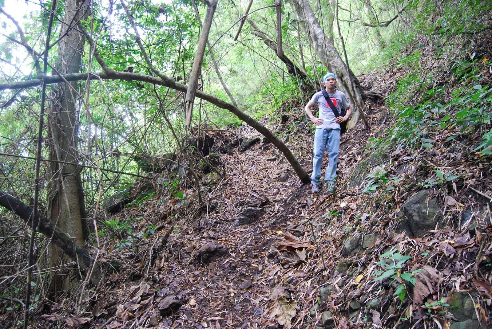
We drove past the club house and parked just before a
small village at the foot of the trail leading to Mt. Batulao. Due to lack of
directional signages, we employed a youthful guide who led us to up to the start
of newer trail. Thereafter, we proceeded
by our selves relying on numbered markers installed by frequent mountaineers. The main trail is actually a horse trail used by small farmers to ply their horse laden with crops back to the main village. They are narrow, about a meter in width and intermittently lined with tall kugon or grass about 6 ft tall. As one starts the trek, the vistas on both sides of the trail keeps your adrenalin high, Cavite’s hills and valleys on the right and Batangas’ on the left. Beautiful sight indeed.
 After an hour of easy hill climb, we stopped to rest,
hydrate and most importantly enjoy the eye and mind soothing view. We joked
around, recalling our weekly grind climbing the Metro Rail Stations (MRT)
stairways, gym workouts and 10k road races now working to our advantage.
After an hour of easy hill climb, we stopped to rest,
hydrate and most importantly enjoy the eye and mind soothing view. We joked
around, recalling our weekly grind climbing the Metro Rail Stations (MRT)
stairways, gym workouts and 10k road races now working to our advantage.
One wonders why the peaks are treeless just covered with lush
kugon. As we approached the last peak just before the highest one, we were greeted
by campers who came to catch the sunset and sunrise. On the same camp, we registered and paid a
nominal fee to defray the camp’s and trail maintenance.


There on, we continued our trek passing through a mini cliff side forest. This wooded area was a treat, like an oasis where Batulao’s indigenous flora congregates in seclusion.


There on, we continued our trek passing through a mini cliff side forest. This wooded area was a treat, like an oasis where Batulao’s indigenous flora congregates in seclusion.
One exits the forested area through an opening between
two tall boulders, then the trail becomes much narrower along cliff sides
adding thrill to the final ascent. A small conspicuous Holy Family tile has
been imbedded on the surface of a rock serving as reminder of safe passage to
and from the peak.


After 2 hours of breath taking treks, we reached Mt.
Batulao’s highest peak. With a lack of
better description, it was a spectacular, breathtaking and a definitely a
worthwhile experience. One can literally
can say: ”you’re on top of the world”. A panoramic 360 degrees view of the
wooded plains, hills and mountains of Batangas & Laguna, Cavite’s plains
and valleys, Balayan Bay, and Nasugbu shoreline. Awesome indeed!


We had our lunch on the peak. While eating we were mesmerized with the view that imprinted in our minds the natural beauty of our country.

After an hour of rest we reluctantly decided to start our
descent. The trek down seemed harder, due to the steep incline with lose rocks
forcing you to take extra precaution from slipping a step.
After 15 minutes of trek, rain clouds appeared and
started to drizzle. We donned our hooded rain jackets and kept our camera water
safe. The rain started to pour brining with it gentle winds and fog that we had
to find shelter in a near by nipa hut. Another beautiful view, seeing the rain
and fog move from one peak to another then passing through you.
After 30 minutes,
the rain ceased and we continued on with our decent on muddy trails. The
temperature and
 scent of fresh air after the rain was pleasant making us forget
our mud soaked shoes and pants.
scent of fresh air after the rain was pleasant making us forget
our mud soaked shoes and pants.


We finally reached the small village at the foot of Mt.
Batulao, there we were greeted by group of mountaineers getting ready to make
their ascent.


Franck and I rinsed up in a village canteen and changed
to dry clothes and sandals. As we drove along Tagaytay the rain continued to
pour again. Franck slept through the
ride exhausted from the magnificent vistas and long trek, but woke up for a
stop in Sta. Rosa’s Chowking for hearty merineda.
Mt. Batulao’s natural beauty has attracted mountaineers
and regular visitors alike. With the simple trails, markers, environmental
reminders and designated campsites in place every Filipino should try climbing the
peak. It is rated as level 1 thus would be a great experience for nature lovers
and brisk walkers.
After this climb, I’m most definite that anyone who
reaches Mt. Batulao’s peak would feel just as amazed as us and enlightened to
value more our country’s natural resources more than ever before.
No comments:
Post a Comment