“I am a stranger on the earth, hide not Thy commandments from me.” - Psalm 119 : 19.

It is an old belief and it is a good belief, that our life is a pilgrim's progress – that we are strangers on the earth, but that though this be so, yet we are not alone for our Father is with us. We are pilgrims, our life is a long walk or journey from earth to Heaven.

We are pilgrims on the earth and strangers – we come from afar and we are going far. -The journey of our life goes from the loving breast of our Mother on earth to the arms of our Father in heaven.

Yet we may not live on casually hour by hour – no we have a strife to strive and a fight to fight. What is it we must do: we must love God with all our strength, with all our might, with all our soul, we must love our neighbors as ourselves. These two commandments we must keep, and if we follow after these, if we are devoted to this, we are not alone, for our Father in Heaven is with us, helps us and guides us, gives us strength day by day, hour by hour, and so we can do all things through Christ who gives us might. We are strangers on the earth, hide not Thy commandments from us. Open Thou our eyes that we may behold wondrous things out of Thy law. Teach us to do Thy will and influence our hearts that the love of Christ may constrain us and that we may be brought to do what we must do to be saved. – Vincent van Gough

Sunday, November 29, 2009

TRANSFORMATION


After our rendezvous in Salcedo Village, we headed for Anilao, Batangas via the Southern Luzon Expressway (SLEX) and the Laguna-Batangas expressway or STAR tollway which ends just before the new Batangas City port.


This Saturday, we had a new junior rockskipper joining us, Annina Nakpil. She is a high school swim team member of the Assumption College, raring to dive again after finishing her NAUI junior diver certification course. Accompanying her was her father, Dennis with buddies Ramon Nakpil, Mikko Rabat and I.


One of our more favorite pastimes on the road is recalling our past experiences in diving among other topics. And this was no better time for Annina to hear our fish stories of yesteryears. We recalled the three to four hours travel time it took to reach Anilao’s (Batangas) main dock. The Bauan road leg onwards was not very sympathetic then to visitors and residents alike. The bumpy, rut-filled pavement doubled our travel time. Once in Anilao, several boatmen waited to greet you in unison, hoping we’d choose one of them and their narrow Briggs-and-Stratton-powered bankas for our diving trip.


Early Resorts

The road along the mountainous coast of Mabini was merely cleared soil. Only sparse overloaded public jeeps or tricycles traversed this road, bringing villagers to and from their residences. During the monsoon season, landslides carrying bamboo trees would intermittently cut-off road access. The most prominent of the beach houses that hardly line this route was that of the late Col. Nerio Andolong’s beach property on the cliff of Barrio Bagalangit. Across the cove was the Aqua Tropical Resort, the first dive resort established in Anilao followed by Divemaster’s Seafari Camp. Both of these resorts catered to foreign diver groups mostly from Japan and Europe. At that time there were hardly any local divers then to profit them.
Soon to follow was Dive 7000, beside Andolong’s. A partnership between the late Dr. Tim Sevilla and a pioneer diving consortium called Aquaventure Phils., Inc., Dive 7000 became the forefront in accommodating the Filipino student divers graduates of Aquaventure’s and divers of the U.S. armed forces stationed in Clark Air Force Base, Subic Naval Station and the Joint U.S. Military Assistance Group (JUSMAG) in Quezon City.   


Early Traps

Anilao’s deep and fast moving waters attracted pelagic fishes to scour its fringing shallow reefs for prey. Back then, local fishing towns built fish traps near the shore called “baklad” made of bamboo poles reaching depths of over 100 feet. Small schools of tuna would unknowingly go through its narrow opening then find themselves blocked by a bamboo screen. As the trapped tuna’s frantically swim in circles, the village watchman assigned on the trap’s watch tower would pull a long string which led to a bell near the village, alerting a team to bring in their net. The team would paddle their small banka inside the trap and lay the net halfway around in the inner side, then raise the net on one side towards the other. The panicky tunas would dart out of the water until the net is finally raised to a larger banka. One could see the tuna fins flapping hard furiously swimming out of the banka.


Over time, these baklads succumb to rotting, eventually collapsing underwater and serving as a haven for other reef fishes. Most commonly seen were huge turkey or lion fishes whose majestic dorsal and caudal fins reached over 10” long. The villagers would also lay bamboo fish basket traps or bubo at the bottom, to catch unwary groupers or lapu-lapus and other reef fishes. The same basket traps were littered all along Anilao’s reefs.


Another kind of fish trap was used called payaw. These were floating fish shelters made of nipa or coconut leaves secured on a bamboo float anchored in deep water. The leaves served as a home for thousands of fish fingerlings. At night, fishing boats would move close to the payaw, shine their kerosene powered fishing lights that attracted squid and other pelagic fishes feeding on the fries then catch them with fish hooks and nets.


Of course, there were those who preferred to shortcut their fishing time. Blast, cyanide and “moro-ami” (the practice of smashing coral reefs with large rocks to force fish out) fishing came into practice, too. These forms of destructive fishing caused irreparable damage to Anilao’s atoll and island reefs.


Schools of large surgeon fishes that once guarded the reefs are no longer there to meet visiting divers. Blasted or overturned large table corals, soft coral vases and other corals are lifeless on their bases.


Today, these traps can no longer be found. Commercial fishing is done further outside from Anilao’s adjacent bays. Numerous diving beach resorts now stand along its coastline – from Bauan’s Ligpo Point all around Maiinit Point in Mabini.


Transformation

For decades, Anilao has captured the diving industry’s eye, transforming it into Luzon’s top diving destination. Having been exposed to foreign and growing local divers, most of Anilao’s villages and resort owners have taken steps to protect and enhance its reefs. 

Over the years, the government also shared in Anilao’s conservation activities. Under the
tutelage of the Department of Tourism, the Philippine Commission for Sport Scuba Diving(PCSSD) installed several mooring buoys along Anilao’s dive sites to prevent further reef damage from boat anchors. The main road leading to the mushrooming resorts and adjacent villages are now well paved, no longer muddy and bumpy. The local communities also established the Anilao-Balayan Resort Owners Association to collectively protect their reefs and the flourishing diving industry in their localities, though internal problems forced the association to cease operation. Haribon Foundation also helped form the  Samahang Pangkaunlaran ng San Teodoro (San Teodoro’s  Association for Progress) and the Samamahn ng Mamgingisda para sa Kaunlarang Pangkapaligiran ng Barangay Solo (Fishermen’s Association for the Progressive Environment of Barrio Solo). In 1991, with the help of the Center for Empowerment and Resource Development, they succeeded in establishing marine protected areas in Batangas. During this period, Bantay Dagat (sea guardians) was also created to patrol the shoreline of each municipality and enforce the law on illegal fishers. But due to lack of funds, its mission has been limited.


The effects of such awareness and effort can be seen in the proliferation of reef fishes and flora as well. Dive and Trek, situated along Barrio San Pablo in Bauan was one of the first dive establishments to promote reef conservation and rehabilitation. With the help of the U.P. Marine Science of Bolinao, Pangasinan and diver environmentalist Louie Mencias, they transplanted giant clams in their reef frontage. Fishing directly on the reef was discouraged. Their efforts resulted to the increase in the variety of large and small fishes residing in and around the reef fronting their facility. Most popular, was a school of jacks taking residence in 15 feet deep of water.


Other resorts followed suit in clam seeding, though poachers arrived to take some of the clams.


The Dives


Today, Anilao’s busiest dive spot is Twin Rocks located in front of Planet Dive resort.  The site receives an average of 50 divers per day on a weekend. Vibrant coral formations and seeded giant clams, anchovies, snappers, large sized resident fishes have taken residence in the area and are ever present. Most notable is the school of jacks similar to those found at Dive and Trek’s a few years back. 


Since Annina had already made dives in Twin Rocks, we planned our first dive at Devil’s Point, located south-south west of Maricaban Island.


It was a pleasant 15 minutes boat ride from Planet Dive to Devil’s Point. Other than the Eagles’ Point annex resort at Sepoc Point, there were no other facilities found along this side of the island. Underwater visibility was clear 25 meters without any current. The coral reefs seem intact though they were not as inhabited as the other reefs fronting resort areas. We also noticed several village paddle boats in queue fishing along the area. 


Rockskippers

We ate our lunch on the beach fronting Meryl’s Rock (adjacent to Devil’s Point). Enjoying the balmy weather Annina strolled along the beach and for the first time saw a number of our namesake rockskippers clinging on to rocks in the breaking surf. She was amazed how these fishes manage to survive above water. After an hour of rest, we snorkeled around Meryl’s Rock and observed the same reef state as Devil’s Point.


We boarded our banka, and then proceeded to Arthur’s Rock. Though the visibility that time wasn’t as clear, the underwater reef was vibrant, opposite from the previous sites we saw. Small and large fishes congregated in and around the reef like a weekend sale in a shopping mall although there were tracks of coral degradation fronting nearby residences.


 Preservation
Although Anilao’s communities has acknowledged that the diving industry has provided their villagers work and better income compared to fishing, there is still much work to concern everyone in the preservation and protection of their shoreline. For decades, most of the shallow reefs have been cleared of corals to allow bangkas to land.  Waste discharges have suffocated corals, killing living polyps and replacing them with slimy, reddish-brown algae.  Ligpo Island for one has not been spared. The lack of vegetation and freshwater has not stopped someone from building a private house on it. The island’s north reef is dead.


Some resorts and residences too have extended their structures onto once beautiful rocky point formations, natural

hot springs and public beach frontages.


Priority should be given in preserving and taking care of the environment over profit. Bauan and Mabini’s natural treasures are not limitless, nor can altered land or seascape be brought back to its original state. It is imperative that consistent communal action be taken to save whatever is left and remedy the mistakes that have been made in order to stop further destruction and perhaps enable nature to reclaim destroyed areas.


An effective way of community environmental awareness is by showing the past-and-present state of local resources, its adverse effects, the identification of specific preserves and employing stakeholders to enforce its guardianship may be a key to lessen further land and reef destruction.


Annina with her father - Dennis


It is our hope that Annina and divers of her generation will be the future narrators of Philippine coastal adventures and become environmental guardians.

Saturday, July 12, 2008

SUBMERGED TOWNS


One of the most popular panoramic vistas nearest to Manila is located in Tagaytay City, Cavite. Owing much to the view of the 26,000 ha Taal Lake and its active Volcano Island with the backdrop of the Batangas and Laguna sierras, the Taal calderas present the most spectacular view in the country.


Volcanic Activity:
History tells us that Taal’s volcano erupted 41 times since 1595. The Batangas towns of Tanauan, Lipa, Bauan and Taal have literally moved three or five times from their original locations due to the destructive boulders, sand, ash and mud laced with sulfuric acid unleashed by the volcano. Records also described how spectators from hundreds of kilometers away watched Taal volcano throw thunderbolts several kilometers into to the sky, while nearby residents were horrified seeing the destruction it rained upon their land. In 1754 the volcano is even said to have erupted continuously for 6 months. 


Transformation:
Located on the lake’s southwestern shore is the 8.2 km-long
Pansipit River. It’s lake side mouth starts in San Nicolas, passing through Agoncillio then ends in the town of Lemery fronting Balayan Bay, facing the South China Sea. Although surrounded by 37 streams, this lone feeder river is the lake’s primary source of water. Taal Lake also receives an annual average rain fall of 2,026 millimeters a year during the months of June to October.

Pansipit was once wide and deep enough to welcome Spanish galleons – and saltwater flora and fauna. Over the centuries, the multiple volcanic eruptions eventually changed its dimensions transforming what was a bay into a lake. But even as the river narrowed and became shallower, migratory fishes continue to spawn in the lake where most of their fingerlings stay inside, adapting to the fresh water environment. Currently, jacks, snappers, turtles, banded sea snakes, tarpons, smelt, damsel fish, mullets and other species take up residence in the lake together with freshwater fishes endemic to the area. Famous among its fauna are the sardines (tawilis) and the jacks (maliputo).

Other familiar species that retain the names of their saltwater counterparts include turtles (pawikan), large milkfish or (sabalo), eel (igat), and red snapper (maya-maya). Taal has a sea snake (hydrophis semperi) similar to its saltwater counterpart with venom as potent as that of land-dwelling cobras. Although not much can be read about this snake, this species is supposedly found only in Taal’s waters. This snake also has a local relative called the file snake or acrochordus granulatus. One can tell that this snake is not venomous like its neighbor by noticing that its tail is not paddle shaped, and the white bands around its hide are not continuous. A transcript dating to 1754 also indicated the presence of sharks and even alligators in the lake.


The Dive Site:
Of the lake’s 120 kilometers of shoreline, the most popular side is at Talisay, just below the 640m (2,100 ft) Tagaytay ridge. This section is accessible either from the ridge or through the Sambat Star Toll exit. The lake’s average depth is 60-65m and the deepest is 160m.


Although we have made previous dives beside the Volcano Island, this time we decided to dive along the mainland coast. Accustomed to the clear sea water, our new rockskipper team member, Bea L. Nakpil was quite hesitant in plunging into Taal’s fresh water. Intrigued by the book "The Mysteries of Taal" written by Prof. Thomas Hargrove, which describes the numerous dives and discoveries he made along Talisay and Balete, we chose a spot called Balas where the town of Tanauan was supposedly originally located before 1754. Hargrove wrote about finding the town’s submerged ruins along this shoreline.


We chose the Holiday Resort as our base, as well as our beach entry and exit points. The resort had a very minimal but comfortable facility which caters to activities such as camping, line fishing, sailing and trekking in the Volcano Island.

The local people were surprised to see that we were actually going to dive in the lake. Although they knew of the sapao or rock formations present in the lake, they did not seem to know much of its origins. 


Fresh Water Aquaria:
Accustomed to clear waters, some of us were having second thoughts in diving in the lake with very limited visibility. Nevertheless, we proceeded with care, following our dive plan to the letter. Knowing the presence of lush, thick Vallisneria Spiralis and Hudrilla Verticilatas, we snorkeled over them and noticed that they were as tall as the depth where they grew.

After swimming a fifty meters out, we shifted using scuba and started our descent using our float line making sure that everyone was in touching distance and had a hold of our buddy line. We touched bottom at 6m (20 ft) where the lake grass was still present, but not as abundant and tall. After a minute of acclimatizing with the 1.2m (4 ft) visibility we followed our planned compass heading, until we reached a depth of 9m (30 ft). From there we turned left. Due to lack of penetrating sun rays, the vegetation ended at a depth of about 7.6m (25 ft). There were seemingly undisturbed piles of vacant unionaceans or elongated mollusks about 10cm (4”) in length covered with brownish algae. Spongillidae or white branching sponges sprouted at random. Gourami fishes 10-15 cm (4-6") in length thrived along the grassy borders, and were startled by our presence. These fishes are just one of the 52 species recorded.

Visibility improved by 1.8m (6 ft) in the deeper areas. Though we encountered small areas with thermocline and halocline, the water was quite still with no evidence of any current.

The bottom sloped to about 45 degrees starting at depth of 7.6m (25 ft). We could not see beyond 4.6m (15 ft) further below due to the predominant brownish tint. After swimming for 50 minutes at 9m (30 ft) with still a lot of air in our cylinders, we decided to end our dive unfulfilled after not seeing any sign of the sapao. 


Coral:
On a separate day, we made another dive in Balas. We swam in the opposite direction weaving the slope at 9-12m (30 to 40 ft). The water visibility was a little better, allowing a clearer view of the fishes and bottom substrate. Small empty corbicula manila clam like shells littered the bottom with larger clusters of spongillidaes. 


  After 30mins we swam back and came across an unusual massive outcropping, like uniformly stacked smoothened rocks (turtle shell shaped) about 30 by 20cm (12 x 8 inches) each covered with black brown algae type material. Bea was ecstatic seeing the unusual formation. We decided to slightly chip an inch-wide off the surface, and then noticed a white coloration underneath. The texture was not of cement, but was quite brittle. Although it didn't look like a well-carved wall, its   
shape and uniformity did not seem to resemble a natural formation either.

We further surveyed the surrounding area to see the extent of this formation. We later marked it with our descent line, terminated our dive and took land fixes from our surface float to mark the spot.

A Piece of History: 
Dr. Hargrove mentioned in his book of old church walls in Taal made of hewn coral blocks. Recalling the white coloration and texture of the chipped rock we saw, we could say that our dives were productive. Although it would take an archeologist to confirm our speculation, we strongly feel that what we saw was a part of a ruin from an ash fall, and we are content to leave it at that for the time being. Who knows what else we might discover in the habitats of Taal Lake’s flora and fauna?

Saturday, April 12, 2008

A FLAT PLACE


With my dive buddies, Ramon and Dennis Nakpil in tow, the early morning fog and mist-filled ridge of Tagaytay all the way down to Batulao highlights the cruise en route to our dive excursion. Sadly, the once-scenic ridge in Luzon, Tagaytay has transformed into a horrific carnival and fast food row complete with candy colored street lights. Fortunately
though, past the Cavite–Batangas boundary only a few new residences have mushroomed saving the pleasantry in driving through. The rolling hills of sugarcane along Nasugbu, the 97-year-old Central Azucarera Don Pedro plantation, the WWII-era trucks hauling the harvests, the scent of molasses along Lian’s bridge, the small sugarcane hills towards Matabungkay, and the grass airstrip on the estate of Don Santiago Zobel and the Ayalas all seem to have been frozen in time. The only things that could be construed as “modern” were the air-conditioned buses that ply the Manila-Calatagan route, a bank ATM, and a branch of the ubiquitous fast food chain Jollibee in Nasugbu.

FLATS
We made a quick stop at the junction of Matuod and Lian’s national road to meet-up with our guest diver and friend, Ed Hontiveros.  Ed is an architect by profession. He and his sister Maan have supported De La Salle University’s Marine Biological Station in Matuod for decades. They work as volunteer research divers helping monitor the marine ecosystem in and around Talin Bay.

After an easy 2½ hour drive, we reached the main town of Calatagan, whose name translates to “a flat place”. The Sto. Domingo de Silos church built in 1913 greets visitors driving entering the town proper. Noticeably, there are more residences and sari-sari stores standing than before as well as a handful of resorts, but no fast food chains. The end of the road wharf that used to accommodate a small cattle barge and a few outrigger boats or bankas is now five times as large, heavily built to accommodate midsized “roll-on roll-off” ferries transporting passengers and goods across the islands of Mindoro.

Calatagan does not describe its own rather hilly landscape as much as it does its underwater terrain. From the inner shores of Pagapas Bay, around the 120-year-old Cape Santiago lighthouse or Punta de Santiago, Lian and all the way up to Nasugbu, the flat sandy substrate is quite consistent, varying only in reef formation.

The Punta de Santiago lighthouse stands 20 meters away from the bluff of the southern most point of Calatagan. It has a 15.5 m
high brick tower topped with a relatively new Japanese-made aluminum lantern. Around which, is a balcony supported by Spanish-designed wrought iron angular grills similar to those in the Capones island lighthouse. Named after its land donor Don Santiago Zobel, Punta de Santiago’s tower can be reached via a cast iron spiral staircase. Its beacon serves as a guide for ships plying the Verde Island Passage between Luzon and Mindoro to and from Manila. For decades, even with this navigational light, Calatagan’s shallow reefs have caused several ships to run aground especially during the stormy months of July-September.

Barrier tidal reefs spread parallel to shore all the way up to the Matabungkay and Nasugbu areas. The reef provides tide pools between the mangroves and the open sea that keeps marine fingerlings safe from large predators, allowing them to grow bigger and stronger before swimming out
into the deep.
 
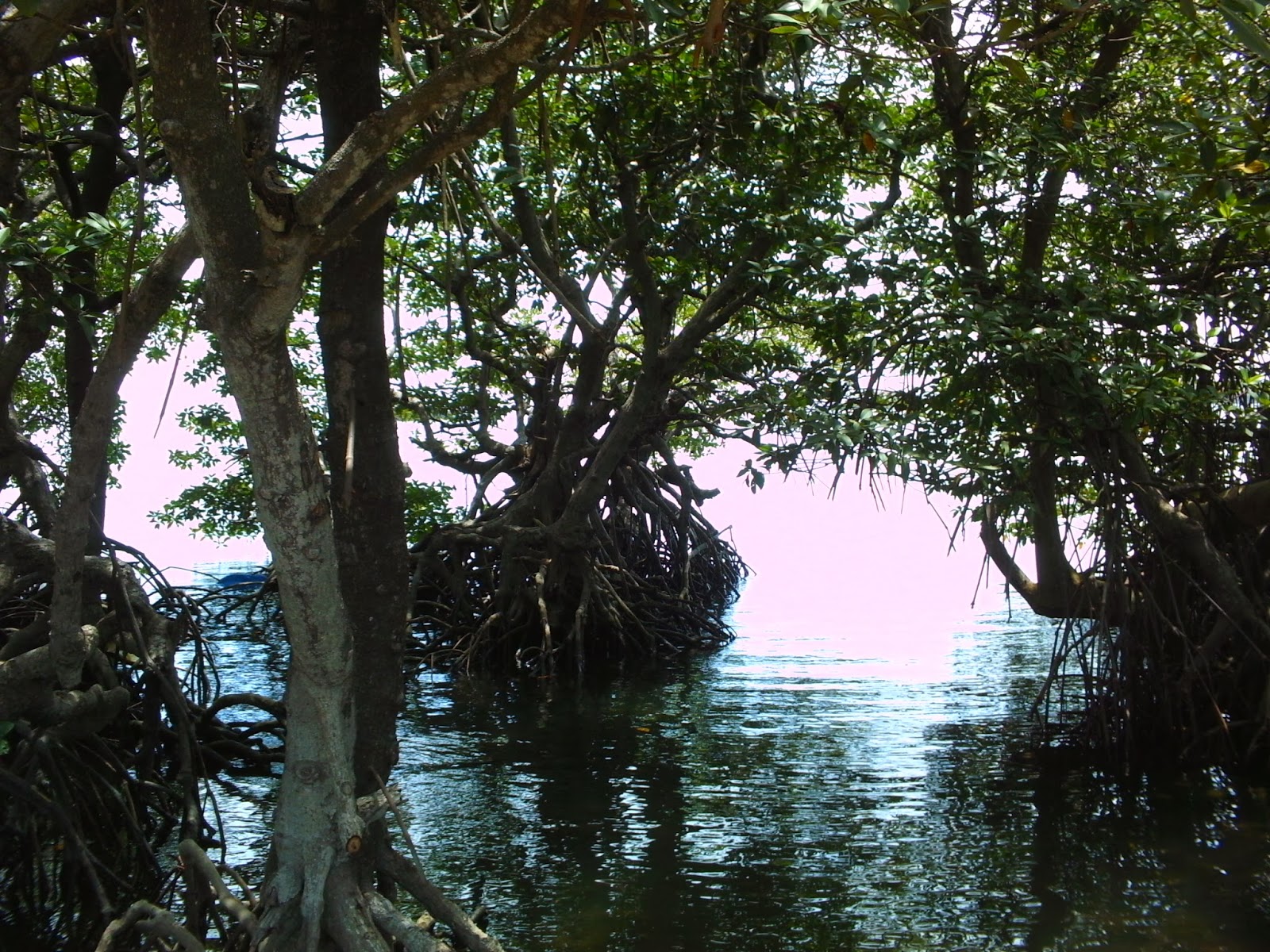
In the 1950’s, approximately 133 hectares of mangrove trees could be seen in Pagapas Bay alone. In the early 90’s only 27 hectares were left. Although Pagapas Bay and the whole municipal waters of Calatagan were declared a Marine Reserve, today the shoreline of Calatagan continues to lose its mangroves, some of which have been replaced with either fish ponds or private beach properties clearing away corals from their frontages, to allow room for more recreational areas or ponds using the same corals as walls or dikes.


HISTORY
Calatagan also has a special place in our country’s history. As early as 1958, archaeologists have found many traces of pre-colonial trade in Calatagan. The Archeological Division of the National Museum made burial site diggings in Kay Tomas (part of the former Hacienda de Calatagan, acquired by the Zobel de Ayala family in 1829) and Pulong Bakaw.  They unearthed 14th and 15th century ceramics such as glass bracelets, bowls, and vessels from China made during the Ming Dynasty, Celadon and Sawankhalok vessels from Thailand and Indo-China, as well as Annamese vessels from Vietnam. They also discovered locally-made pottery such as earthenware jars, plates, basins, pots, and other vessels with different patterns made by incisions and impressions. One of the more famous jars found was called the Calatagan Jar or Bangang Kalatagan, which has inscriptions in the Philippines most ancient script, Baybayin.

Other than the National Museum, a few of these artifacts and replicas can also be seen in a resort in Kay Tomas, whose frontage was once a mangrove area.

FISHING GROUND
Since we were not aware of any dive resort in Calatagan, we rented scuba cylinders from Milton Pedrigal the day before leaving Manila. Milton is a good friend and one of the old salts in the diving community who specializes in rebuilding and repairing scuba compressors.

Finding a boat for diving in Calatagan was quite a task. Luckily, Ramon managed to find our aging boatman, Mang Joaquin who arranged the most suitable boat for us. Though he no longer steers boats, his nephew was just as skillful. A relic of the past, only a Briggs-and-Stratton powered Bangka fit for three divers (we were four with 8 tanks plus gear) allowed us to slugushly access the sites. 

We set our base beside a nipa hut adjacent 
to Playa Calatagan, a leisure-commercial-residential resort. The frontage consisted of white sandy beach that stretched out flat to the intertidal zone ending in a natural barrier reef. It was the closest place for the boat to dock and load our gear. 

We made our first dive near the dead lighthouse or parolang patay. After missing the reef for almost an hour, we finally found one and were surprised to see a few healthy reefs with some juvenile groupers, gray sweet lips, and a juvenile turtle. Dennis and Ed missed the reef and spent their bottom time swimming on the sandy bottom. Not all the corals were as colorful; some were covered with brown algae.

Since we didn’t see any access to a nearby shore, we decided to motor back and have lunch in our base. Under the coconut trees, on a bamboo table and benches we exchanged pleasantries as we ate our meal and enjoyed the cool sea breeze and view.

Reef clusters or pulo-pulo are quite abundant in the deeper reef of Calatagan. Though a bit hard to spot, they are located several meters out from the barrier reef and extend past 90 feet deep almost a kilometer away from shore. Flat sandy beds are quite common.

Decades ago, gargantuan predators such as the marble grouper or kalatang (or super large lapu-lapu) dominated the reef together with the square and moon tail or secilla groupers, hunchback or apahap groupers. Red snappers, huge moray eels, sweet lips, sting rays, and cuttle-fishes hopped from one reef to another in seek of their prey.  Spiny lobsters such as the green, blue, brown, curacha, and the pitik also lived communally in the area. Green turtles can often be seen surfacing to take a breath of air if not resting on a reef. Large needle-nose fish, flying fishes, jacks and mantas would from time-to-time jump out of the water escaping from a predator, while a few sports fishers/anglers would also wait out at sea for a jack or a king mackerel to take a bite off their baited hooks.

According to the 2006 initial samplings made by the University of the Philippines Marine Science Institute, the water circulating within the Verde Island Passage corridor distribute spawning areas and settlement sites in certain months of the year. The western part of Balayan Bay including Calatagan’s Pagaspas and Punta de Santiago area have high densities of fish eggs and larvae. Even higher concentrations can be found around Tingloy, Verde Island, the islets and shoals of Calapan and Puerto Galera.


OVER FISHING
Even with the intervention of coastal resource management groups along the Nasugbu, Lian and Calatagan shores and the presence of the Bantay Dagat, the effects of illegal fishing have taken its toll in Calatagan’s reefs. Empty coral heads and the presence of brownish slime encapsulating sections of its reef give it a ghostly aura.   

Regarded as sea guardians by the local populace, the Bantay Dagat (lit. “Sea Guard”) are made up of civilian volunteers tasked to keep a 24-hour watch on Philippine coastal waters up to 15 kilometers from shore. Equipped with patrol boats, they are only allowed to protect municipal waters as mandated by law. Calatagan’s Bantay Dagat has a base near Punta de Santiago where they also provide a dive guide and a few diving equipment for hire for those wishing to tour the several artificial reefs in front of the Madrigal’s beach house.

The Calatagan Artificial Reef and Fish Sanctuary was established in 1999 by Vicente Madrigal Warns with the cooperation of the Barangay Bagong Silang and help from volunteer divers. In response to the rampant blast and cyanide fishing occurring in the area, the project was conceived as a tool for community awareness to protect and preserve their marine ecosystem and for the artificial reef to serve as a new breeding haven for both new and displaced marine faunas.

We decided to make our second dive on the artificial reef site. As we descended past one of the buoy markers, one could see a strange looking dark and massive object at the bottom. Once the view became clearer, you get to feel as if you’re landing on a Mayan-pyramid. The main artificial reefs truly looked like one, measuring around 13 meters tall on its apex and 10 meters wide at the base the monolithic structure is a pile of molded
blocks made of mortar mixed with discarded corals with interconnecting open canals from one reef to another. Each hallow blocks had tube entrances leading to its inner chamber. There were also some four foot hallow pyramids littered on the sandy bottom. Young coral encrustations and small reef fishes have already taken foot on these man made structures.

After the dive we headed back to our base. We took turns in bathing, one pumping by hand the cold deep well water outside the hut.

The end of the dive brought us mixed feelings. The unexpected sighting of a variety of marine life and seeing the artificial reef was a treat. On the other hand, we were disappointed to see traces of dead coral heads and wondered if the remaining reefs and surrounding ecosystem are being monitored.

TREASURES
After decades of skipping out on Calatagan in our dive destinations list, we found some of its marine resources in a much better state than Matabungkay and Nasugbu areas. The effects of fish pond expansion, its discharges and resort development should be of great concern to the community.

Hopefully, the communal guardians and residents will continue to work in unison  pursuing their mission in helping Calatagan’s reefs, tidal flats, mangroves, and interconnecting natural resources to recover, and bring back its myriad of marine treasures for its people and future generations.

Amidst all the changes it has undergone, Calatagan is still a quiet provincial town. Whatever transformations its settlers and migrants wish to make, it must be tempered with a continued proactive concern and respect for their coastal environment.